Report from November 14, 2022:
Mick and April are joining me on this trip. They are staying in a Yurt from 11/12-11/16. I am staying from 11/14-11/17.
Previous Report from October 18, 2021:
I enjoyed the drive from Vancouver to Westport. Here is my online tour guide for this driving trip.
Today was a very nice day with wide fairly clear views. I encountered little traffic on WA 4. I pulled off at my favorite viewpoint rest stops for the Columbia River before Skamokava. Inland WA4 and US101 was covered with plantation reforestation and with many beautiful large trees in their fading autumn yellow-brown rusted leaves, and the scarlet-green-brown fading leaves of the wild berry vines.
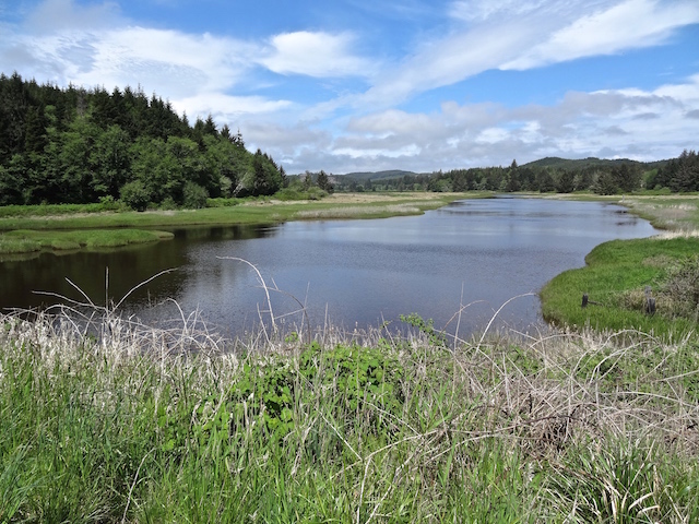
Then BAM!! A sough wandering under 101, and vast stretches of wild grasses and then grand views of Willapa Bay all the way to South Bend.
Willapa Bay Hypertext Notebook by Michael P. Garofalo.
I enjoyed eating at the River View Restaurant along the Willapa River docks in South Bend. I watched one chef tending a big 6 foot long steel steamer. He added wood logs and used a flame torch to arouse the fire. Then he placed many fresh Willapa Bay Oysters on the huge steel grill. He closed the top of the steamer and talked amicably with a passing walker for a few minutes. The cook looked Nordic, and the walker looked Indian-Asian. Then, the big man, went back to tending his steamer oysters, and he added some magical pasting for local flavor.
I enjoyed two oysters, and a bowl of clam chowder. Memorable eating and seeing! Two women and a man at a nearby table ordered a dozen oysters and more for their feast of the day.
The word for oyster in the Chinook Jargon was chet'-lo, or jet'-lo.
Clams were called o'-na, luk'-ut-chee, la-kwit'-chee.
Water or River called chuck
Native peoples, speaking different languages, lived for thousands of years along the Willapa River, the Chelais River, the Cowlitz River, the Naselle River, the Lewis River, and the Columbia River.
Here are the books I have been reading about Willapa Bay:
Coast Country: A History of Southwest Washington. By Lucile McDonald. Long Beach, Midway Printery, 1989. Index, 183 pages. TRLS = Timberland Regional Library System, WA [I pick up my reserved books and videos as the Westport Branch of the TRLS.].
Shoalwater Willapa., By Douglas Allen. Snoose Peak Publishing, South Bend, WA, 2004. Index, notes, sources, 286 pages. TRLS.
Telling Our Stories: Voices of Grays Harbor. By students of the Evergreen State College, Grays Harbor Campus. Gorham Printing, Centralia, WA, 2012. 155 pages. TRLS.
A Tidewater Place: Portrait of the Willapa Ecosystem. By The Willapa Alliance, Long Beach, WA, 1993. Color photographs and text, 50 pages. TRLS.
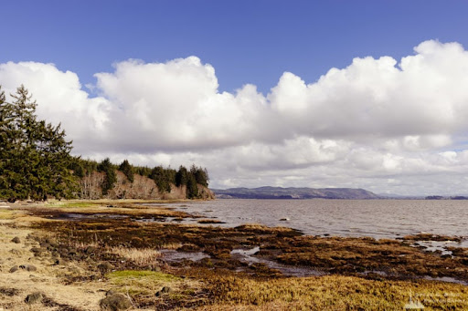
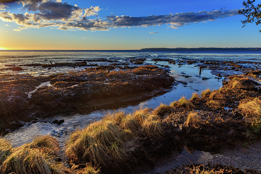
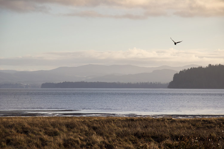
Willapa Bay Estuaries There are many estuaries at the mouths of the various rivers that flow into Willapa Bay, and the Bay itself is an estuary.
"Willapa Bay is a major estuary on the Pacific Coast and at mean high tide encompasses approximately 70,400 acres (28,500 hectares). An estuary is defined as the area near the mouth of a river, or rivers, in the case of Willapa Bay, where oceanic tidal waters and freshwater currents collide and mix. Biologically, estuaries are among the most productive environments on earth and provide important habitat for a large variety of organisms. This high productivity is due basically to physical and biological processes unique to estuaries. Dissolved organic nutrients from detrital (dead plants and animals, and excrement) material enter the estuary from inflowing rivers. Saltwater pushed along the estuary bottom by the incoming tide brings in other nutrients of marine origin. Currents and tides circulate fresh and salt water, distributing and, to a certain extent, trapping dissolved and suspended matter. Deposition of these substances fertilizes the estuary and plant life flourishes. This plant life includes grasses, rushes, sedges of estuarine marshes, benthic algae (diatoms), epi-benthic algae, and eelgrass on intertidal sediments. Some plants are fed upon directly by fish and wildlife but most die and enter the food chain in the form of detritus or partly decomposed plant material. This detritus, suspended in the water and deposited on the bottom, is a high-quality food for consumers because of its high nutritional value. A number of studies have shown that many species of fish and invertebrates feed wholly or partially on detritus. Therefore, detritus feeders are the critical link between plant production and the production of higher consumers. Consequently, the ultimate ecological value of primary production in marshes occurs when detritus of marsh plant origin enters the food web of the estuary." Willapa Estuary
"An estuary is a partially enclosed coastal body of brackish water with one or more rivers or streams flowing into it, and with a free connection to the open sea. Estuaries form a transition zone between river environments and maritime environments and are an example of an ecotone. Estuaries are subject both to marine influences such as tides, waves, and the influx of saline water and to riverine influences such as flows of freshwater and sediment. The mixing of seawater and freshwater provides high levels of nutrients both in the water column and in sediment, making estuaries among the most productive natural habitats in the world."
"Estuaries are a happy land, rich in the continent itself, stirred by the forces of nature like the soup of a French chef; the home of myriad forms of life from bacteria and protozoans to grasses and mammals; the nursery, resting place, and refuge of countless things." - Stanely A. Cain
Four Days in Grayland, Part I
Grays Harbor and Willapa Bay: A Traveler's Hypertext Notebook and Guide
Four Days in Grayland, Part II
Grayland Beach: A Camper's Hypertext Notebook, Studies, and Comments
Four Days in Grayland, Part III
Photographs, Blog Posts, and Notes from 2021-2022
Four Days in Grayland, Part IV
Reflections of a Beachcomber: Poetry, Short Essays, Commentary, Quotations
The Four Days in Grayland Series began in September, 2021.